Changing:
The Evolution of Boreal Forests
Benjamin Olson's long-term project on northeastern Minnesota, where he is documenting the effects of climate change.
Share This Post:
Benjamin Olson
Benjamin has spent half of his life studying and chasing light in ephemeral seasons. Working in a natural environment with no contro…
About Changing: The Evolution of Boreal Forests
Introduction
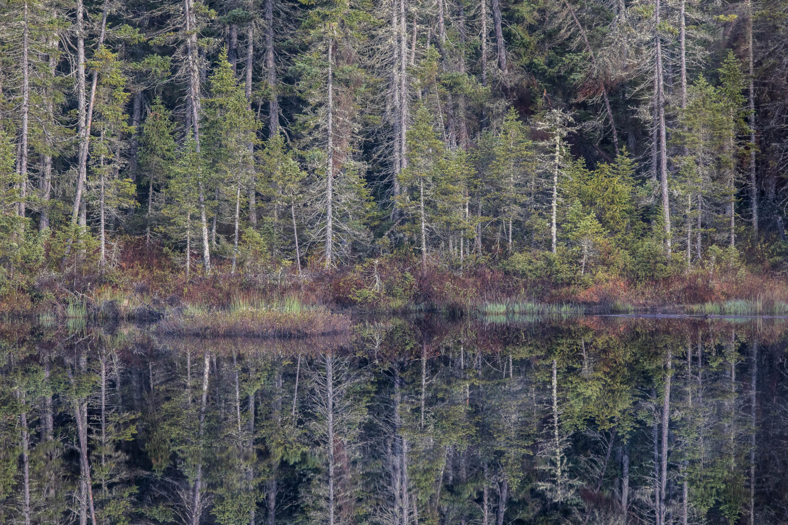
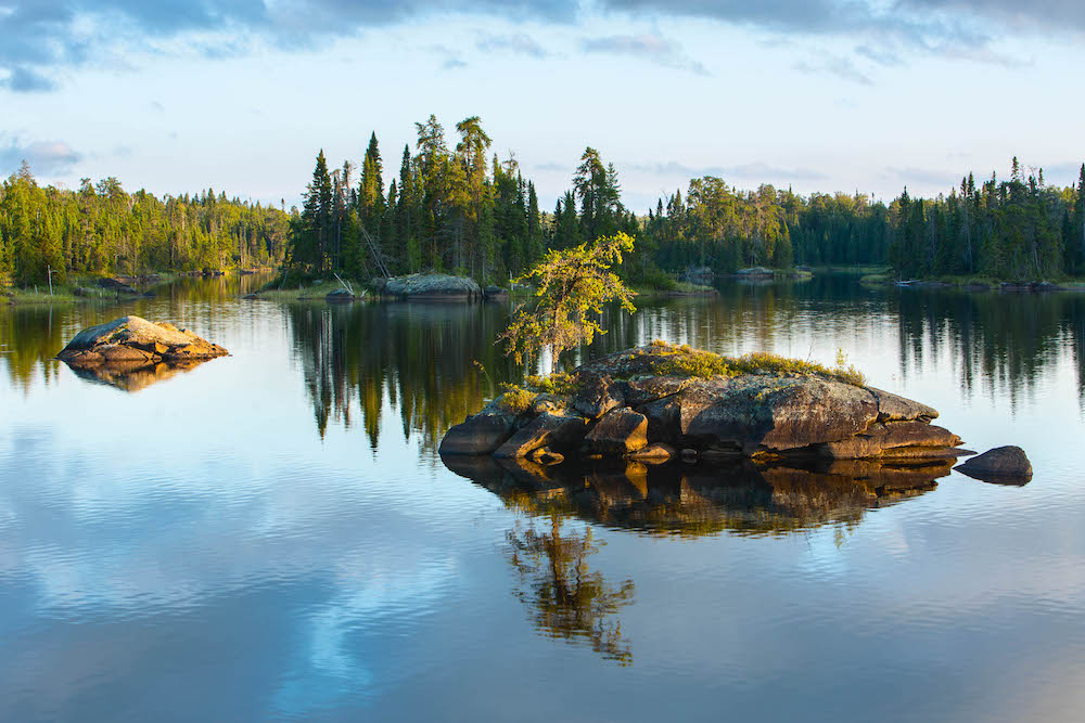
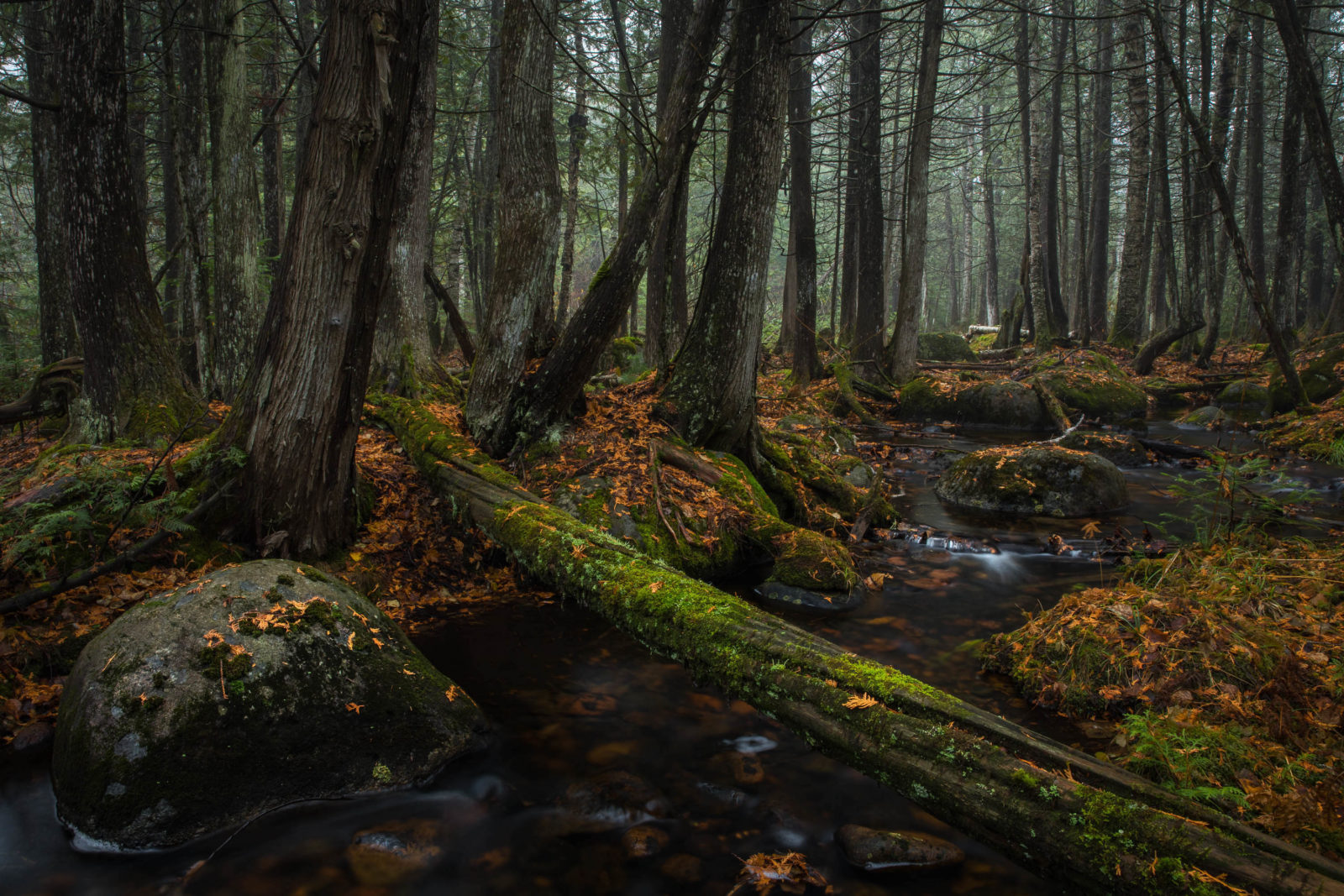
Minnesota’s northeastern corner is dominated by one ecosystem—the boreal forest. Covering 3.9 million acres, including over 445,000 acres of water, northeastern Minnesota is covered by dense forests, freckled with lakes, and veined by rivers and streams. The entire region is defined by water and the interconnectedness it provides. Northeastern Minnesota is a living, breathing ecosystem feeding water into Lake Superior, Lake Winnipeg, and Hudson Bay. It is also a major hotspot for observing the effects of climate change, where the impacts are resonating through its core.
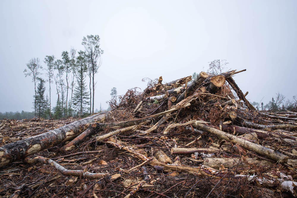
There are three major components to the story of the northeastern Minnesota: natural history, climate change, and socioeconomic interest. The region is wild Minnesota, it includes the Boundary Waters Canoe Area Wilderness (BWCAW), which draws visitors from across the world and is Minnesota’s most popular wilderness area. This is one of Minnesota’s most prized treasures and part of the state’s most valued natural resources. This all stands to disappear from our backyard and shift over 300 miles northeast. The main driver being climate change, which displaces species endemic to boreal forests due to increased temperatures and overall degradation of the boreal ecosystem. Other issues, such as mining, could have localized impacts on the region if industry safeguards fail, potentially leading to pollution flowing through the wilderness, Lake Superior, Lake Winnipeg, and Hudson Bay.
The Project
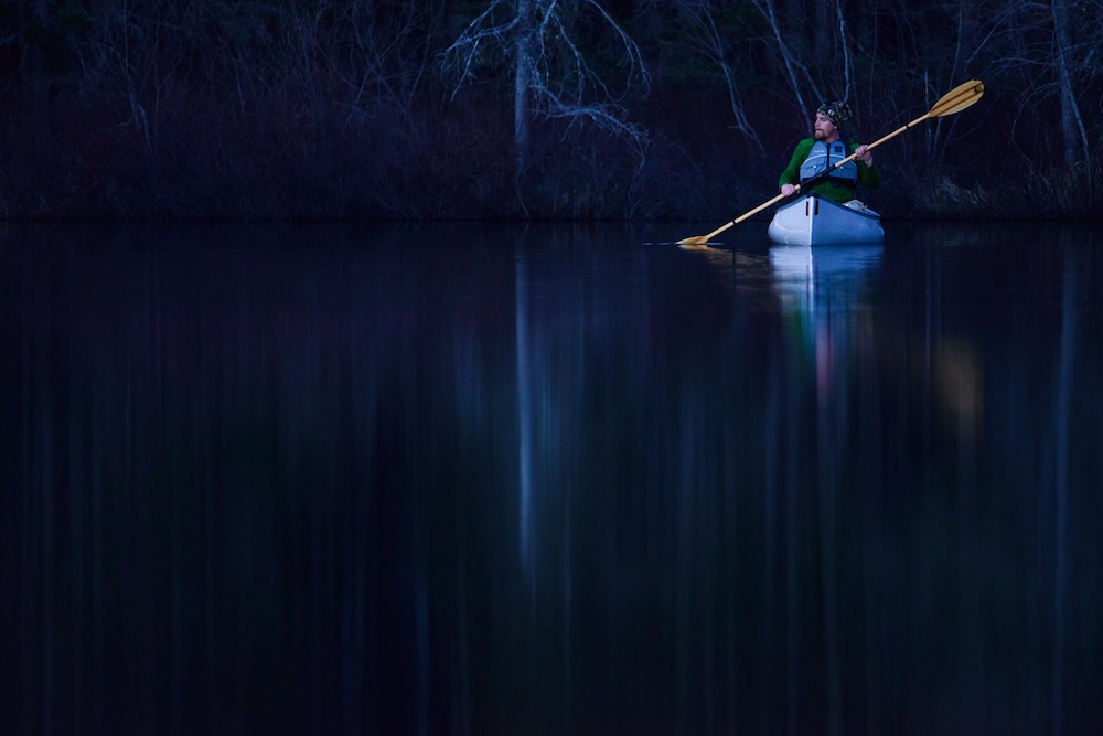
The history and the future of northeastern Minnesota is complex. I have been exploring, studying, and photographing this region for almost two decades. I have committed my life to this region. By combining my education, immense exploration, my passion for photography and wilderness I am determined to document the relationship the communities, tourists, scientists, and wildlife all share: a dependence on natural and protected greenspaces.
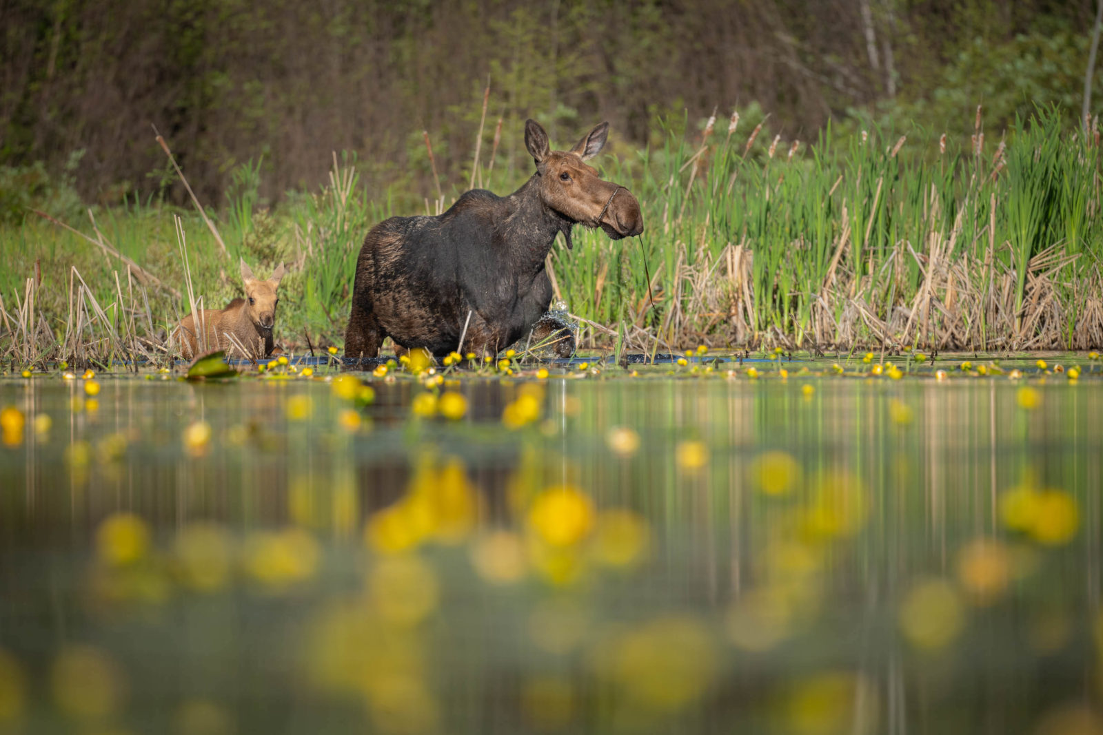
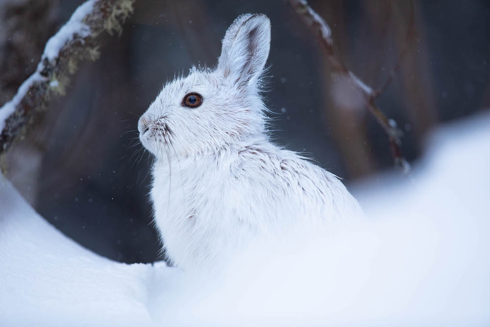
Minnesota has numerous species which have begun to decline. The three most iconic wildlife species that are threatened by climate change are the moose, loon, and lynx. Moose are arguably most at threat. With a decrease in population of 60% over their historic range, moose are facing addition to the Endangered Species list in the Midwest. Four additional threats are affecting moose as well: a warming climate, northward movement of white-tailed deer into suitable moose habitat, parasites that are introduced by deer, and predators. Camera traps will be used to illustrate the spatial overlap of moose and white-tailed deer. Relevant research will be documented as well.
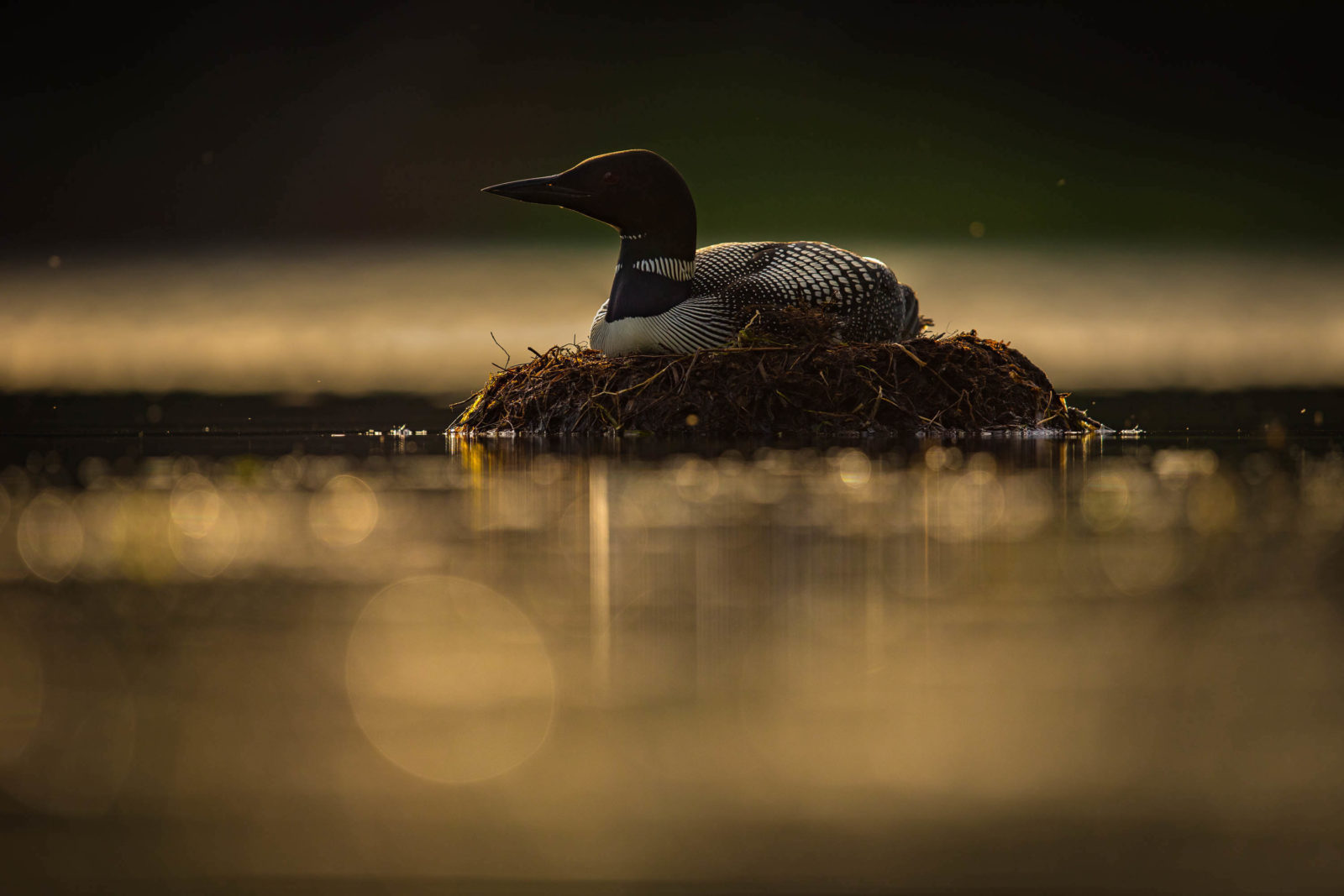
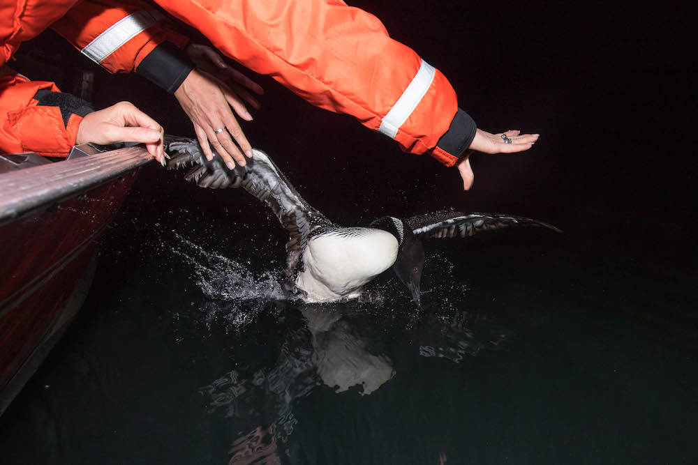
The second iconic species in northeastern Minnesota is the common loon, Minnesota’s state bird. The common loon is projected to be gone from our waters as soon as 2080. The summer range of these birds will shift over 300 miles northeast with the boreal forest boundary. Minnesota is the land of 10,000 lakes and the loss of the loon and their song will leave a haunting void in every Minnesotan’s heart. A combination of traditional and underwater photography, along with science communication will be pursued to illustrate issues both above and below the water. Relevant research will be documented as well.
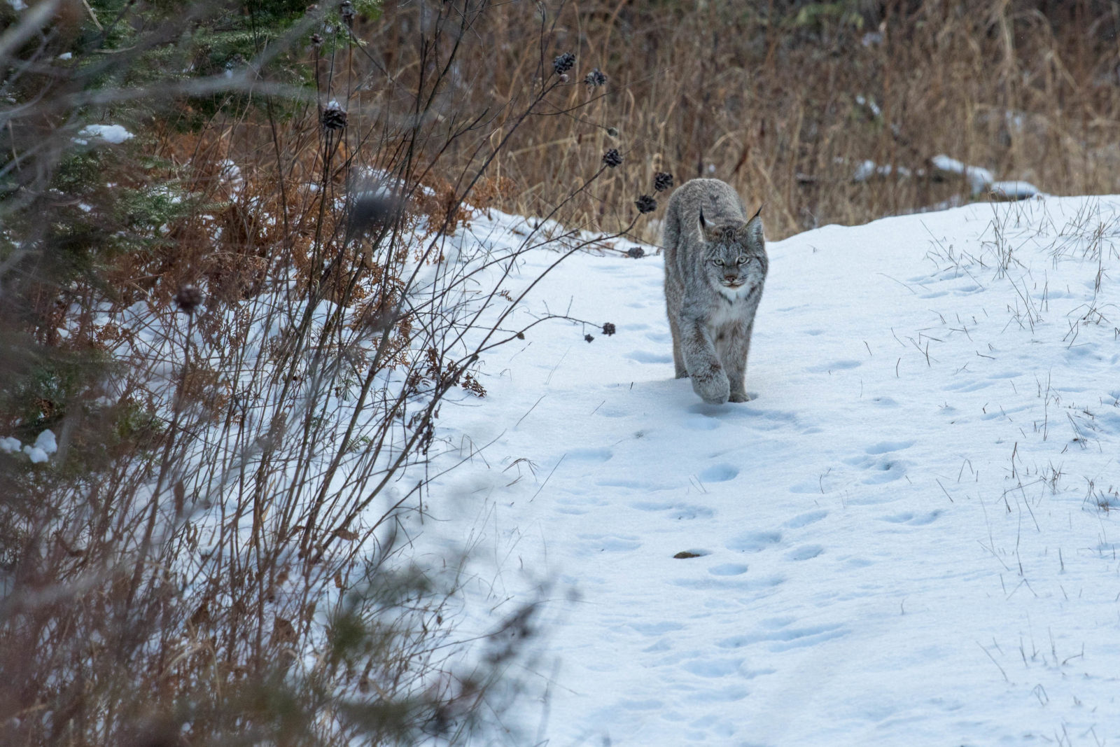
The Canada lynx is the third threatened wildlife species in northeastern Minnesota. Shallow snow depths have resulted in bobcats moving northward, which outcompete and hybridize with lynx. These cats are also dependent upon early successional forests. Their prey relies on coniferous forests and without them, population density of snowshoe hare decreases and subsequently, the lynx. Camera traps will be used to document lynx in preferred habitat in contrast with forest succession, and the spatial overlap between bobcats and lynx. Relevant research will be documented as well.
In areas of major disturbance, such as climate change induced blowdowns, logging sites, or extreme heat fires that burn canopies of boreal forests I will deploy time lapse cameras (10 initially, ideally 20) for a the remainder of my life. Each system will be left in the same location for the duration of the project. The cameras will capture one image a day year-round. Each year the images from each camera will be compiled into a time-lapse video to depict real-time forest succession, this will take many years for the changes to become evident. High numbers of cameras will be used to compensate for system failures and environmental damages.